Google maps is over 13 years old this year and has come a long way since it was introduced way back in 2005. Though originally meant as a project to enable us to explore the globe from the comfort of our favourite chair, Google Maps has become so much more than that. The internet is full of discussions about various things that have been caught on Google Maps’ satellite and Street View images, with new things being discovered every single day.
Since Google maps has been introduced there have been various sightings of strange looking people, naked people, unidentified landmarks and even lost cities.
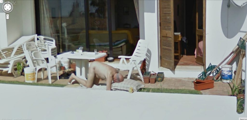
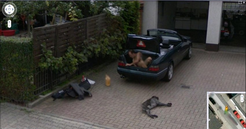
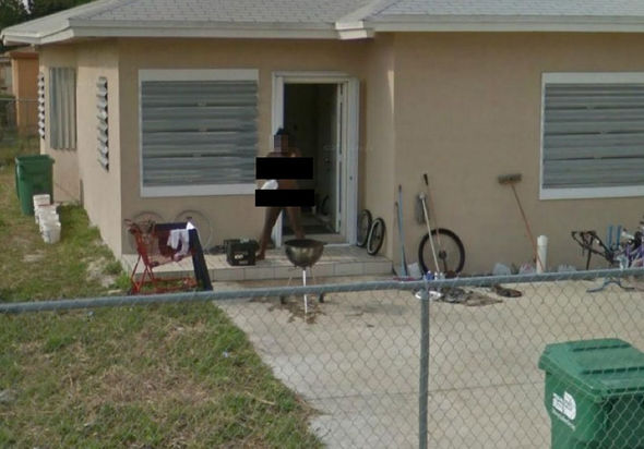
Naked people on Google Maps
With over 7 billion people on the planet, there is a great chance that at any given time many people will be naked. But what are the odds of being caught naked by the Google Street View car? Apparently, quite high:
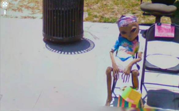
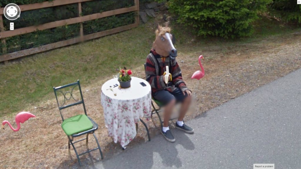
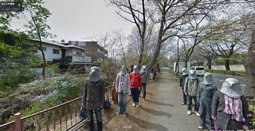
Strange people on Google Maps
There is no shortage of strange people on earth anyway, so it’s no surprise that so many weird looking people have also been seen on Google Street View:
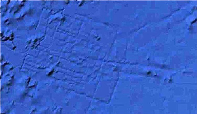
When it comes to lost cities, many people think of Atlantis. And many people were very excited when they thought that they were the first people on earth to have discovered part of the lost continent of Atlantis on Google Maps. There are hundreds of forum posts and discussions about the discovery, which – according to Google – is just a digital artefact created by the sonar boats when collecting mapping data.
When it comes to strange things that have been seen on Google Maps, there are more than naked, strange looking people and lost cities that have been discovered. Thousands of unusual or unidentified landmarks have been seen across the globe, and despite being in the spotlight for a few years now, many of them haven’t been adequately explained. Here are a few examples of such landmarks.
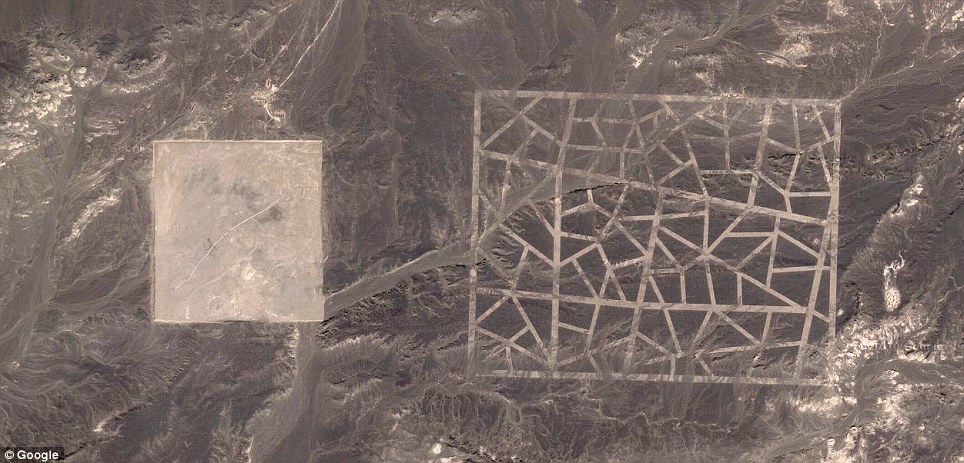
This huge pattern was seen using Google Maps and is located in the Gobi desert, North China. It’s over a mile wide and apart from the official explanation of it being a calibration mark for China’s satellites, many people are sceptical.
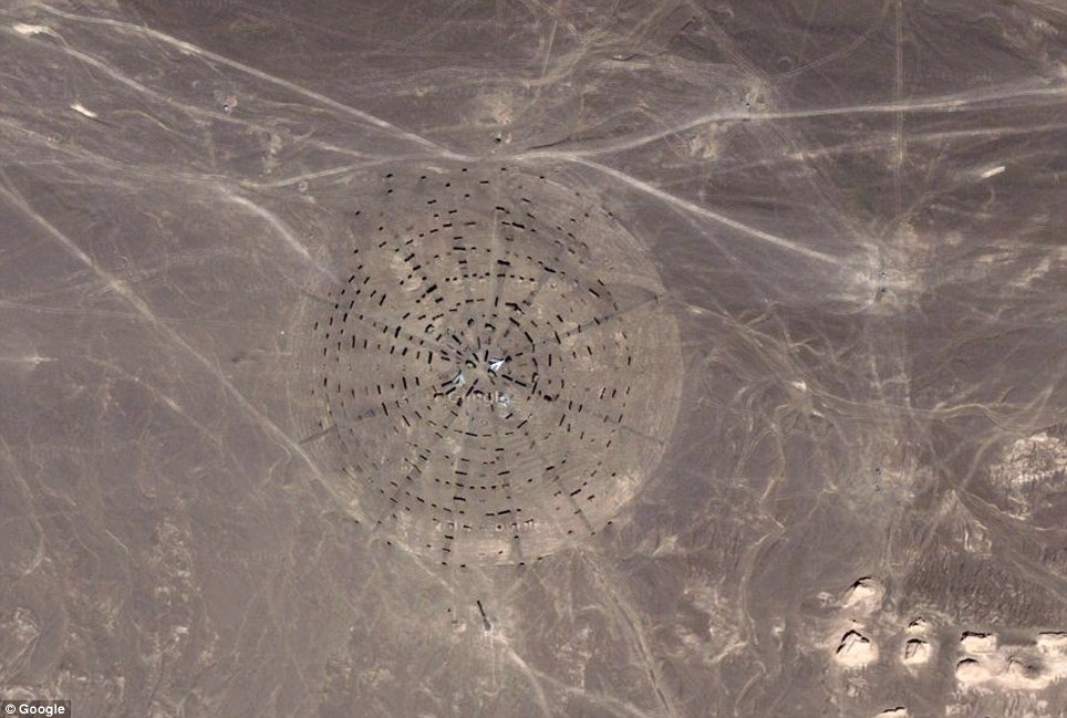
The above landmark is also located in North China, in an area that is well-known for building military, space and nuclear equipment. In this particular image you can see planes and burned out cars quite clearly, further fuelling rumours that this isn’t something ordinary.
So there you have it, just a few of the many thousands of unexplained anomalies that have been appearing on Google maps over the last 12 years. As the Google satellites circle the globe in the future we can only expect to see even more inexplicable sightings both from above and at street level.